
 A SCHOLARLY BOOK REPOSITORY
16 start with M start with M
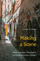
In the three largest cities in Sweden, social movement “scenes”—networks of social movement actors and the places they inhabit—challenge threats such as gentrification. The geography of the built environment influences their ability to lay claim to urban space and to local political processes. In Making a Scene, Kimberly Creasap emphasizes that it is the centrality, concentration, and visibility of these scenes that make them most effective. Whereas some scenes become embedded as part of everyday life—as in Malmö—in contrast, scenes in Göteborg and Stockholm often fail to become part of the fabric of urban neighborhoods.
Creasap investigates key spaces for scenes, from abandoned industrial areas and punk clubs to street festivals, bookstores, and social centers, to show how activists create sites and develop structures of resistance that are anti-capitalist, anti-fascist, anti-gentrification, queer, and feminist. She also charts the relationship between scenes and city spaces to show these autonomous social movements create their own cultural landscapes. Making a Scene encourages critical thinking about spatiality and place in the sociology of social movements and the role of social movements as important actors in urban development.
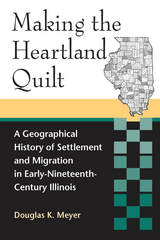
In Making the Heartland Quilt, Douglas K. Meyer reconstructs the settlement patterns of thirty-three immigrant groups and confirms the emergence of discrete culture regions and regional way stations. Meyer argues that midcontinental Illinois symbolizes a historic test strip of the diverse population origins that unfolded during the Great Migration. Basing his research on the 1850 U.S. manuscript schedules, Meyer dissects the geographical configurations of twenty-three native and ten foreign-born adult male immigrant groups who peopled Illinois. His historical geographical approach leads to the comprehension of a new and clearer map of settlement and migration history in the state.
Meyer finds that both cohesive and mixed immigrant settlements were established. Balkan-like immigrant enclaves or islands were interwoven into evolving local, regional, and national settlement networks. The midcontinental location of Illinois, its water and land linkages, and its lengthy north-south axis enhanced cultural diversity. The barrier effect of Lake Michigan contributed to the convergence and mixing of immigrants. Thus, Meyer demonstrates, Illinois epitomizes midwestern dichotomies: northern versus southern; native-born versus foreign-born; rural versus urban; and agricultural versus manufacturing.
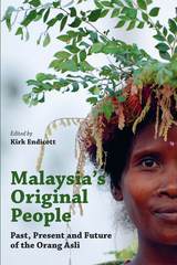
The chapters in the present volume provide a comprehensive survey of current understandings of Malaysia’s Orang Asli communities, covering their origins and history, cultural similarities and differences, and they ways they are responding to the challenges posed by a rapidly changing world. The authors, a distinguished group of Malaysian (including Orang Asli) and international scholars with expertise in anthropology, archaeology, biology, education, therapy, geography and law, also show the importance of Orang Asli studies for the anthropological understanding of small-scale indigenous societies in general.
The authors argue that the roles of these systems in cyberspace cannot be fully understood unless they are seen as mutually constituting each other in specific historical structures, institutions, and practices. With vision and insight, the authors look beyond the Internet to examine the entire networked world, from cell phones and satellites to global tourism and business travel.
“I love maps. I love math. And gosh, do I love this book, which so beautifully and clearly sounds the depths of both.” —Ben Orlin, author of Math with Bad Drawings
Explore the surprising connections between math and maps—and the myriad ways they’ve shaped our world and us.
Why are coastlines and borders so difficult to measure? How does a UPS driver deliver hundreds of packages in a single day? And where do elusive serial killers hide? The answers lie in the crucial connection between maps and math.
In Mapmatics, mathematician Paulina Rowińska leads us on a riveting journey around the globe to discover how maps and math are deeply entwined, and always have been. From a sixteenth-century map, an indispensable navigation tool that exaggerates the size of northern countries, to public transport maps that both guide and confound passengers, to congressional maps that can empower or silence whole communities, she reveals how maps and math have shaped not only our sense of space but our worldview. In her hands, we learn how to read maps like a mathematician—to extract richer information and, just as importantly, to question our conclusions by asking what we don’t see.
Written with authority and compassion, wit and unforgettable storytelling, this is math exposition at its best. By unpacking the math behind the maps we depend on, Mapmatics illuminates how our world works and, ultimately, how we can better look after it.

Contributors discuss this relationship, and analyze several different possibilities for the future. Mappae Mundi will appeal to social scientists or anyone interested in the current and future consequences of our interaction with the natural environment.
Any landscape has an unseen component: a subjective component of experience, memory, and narrative which people familiar with the place understand to be an integral part of its geography but which outsiders may not suspect the existence of—unless they listen and read carefully. This invisible landscape is make visible though stories, and these stories are the focus of this engrossing book.
Traveling across the invisible landscape in which we imaginatively dwell, Kent Ryden—himself a most careful listener and reader—asks the following questions. What categories of meaning do we read into our surroundings? What forms of expression serve as the most reliable maps to understanding those meanings? Our sense of any place, he argues, consists of a deeply ingrained experiential knowledge of its physical makeup; an awareness of its communal and personal history; a sense of our identity as being inextricably bound up with its events and ways of life; and an emotional reaction, positive or negative, to its meanings and memories.
Ryden demonstrates that both folk and literary narratives about place bear a striking thematic and stylistic resemblance. Accordingly, Mapping the Invisible Landscape examines both kinds of narratives. For his oral materials, Ryden provides an in-depth analysis of narratives collected in the Coeur d'Alene mining district in the Idaho panhandle; for his consideration of written works, he explores the “essay of place,” the personal essay which takes as its subject a particular place and a writer's relationship to that place.
Drawing on methods and materials from geography, folklore, and literature, Mapping the Invisible Landscape offers a broadly interdisciplinary analysis of the way we situate ourselves imaginatively in the landscape, the way we inscribe its surface with stories. Written in an extremely engaging style, this book will lead its readers to an awareness of the vital role that a sense of place plays in the formation of local cultures, to an understanding of the many-layered ways in which place interacts with individual lives, and to renewed appreciation of the places in their own lives and landscapes.
Master Plans and Minor Acts examines a “material politics of repair” in post-genocide Rwanda, where in a country saturated with deep historical memory, spatial master planning aims to drastically redesign urban spaces. How is the post-conflict city reconstituted through the work of such planning, and with what effects for material repair and social conciliation?
Through extended ethnographic and qualitative research in Rwanda in the decades after the genocide of 1994, this book questions how repair after conflict is realized amidst large-scale urban transformation. Bridging African studies, urban studies, and human geography in its scope, this work ties Rwanda’s transformation to contexts of urban change in other post-conflict spaces, bringing to the fore critical questions about the ethics of planning in such complex geographies.
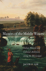
A riveting account of the conquest of the vast American heartland that offers a vital reconsideration of the relationship between Native Americans and European colonists, and the pivotal role of the mighty Mississippi.
America’s waterways were once the superhighways of travel and communication. Cutting a central line across the landscape, with tributaries connecting the South to the Great Plains and the Great Lakes, the Mississippi River meant wealth, knowledge, and power for those who could master it. In this ambitious and elegantly written account of the conquest of the West, Jacob Lee offers a new understanding of early America based on the long history of warfare and resistance in the Mississippi River valley.
Lee traces the Native kinship ties that determined which nations rose and fell in the period before the Illinois became dominant. With a complex network of allies stretching from Lake Superior to Arkansas, the Illinois were at the height of their power in 1673 when the first French explorers—fur trader Louis Jolliet and Jesuit priest Jacques Marquette—made their way down the Mississippi. Over the next century, a succession of European empires claimed parts of the midcontinent, but they all faced the challenge of navigating Native alliances and social structures that had existed for centuries. When American settlers claimed the region in the early nineteenth century, they overturned 150 years of interaction between Indians and Europeans.
Masters of the Middle Waters shows that the Mississippi and its tributaries were never simply a backdrop to unfolding events. We cannot understand the trajectory of early America without taking into account the vast heartland and its waterways, which advanced and thwarted the aspirations of Native nations, European imperialists, and American settlers alike.
The potential role of NATO is controversial but crucial to the future of the Mediterranean. Some contributors suggest that the southward expansion of NATO could be an important first step toward stability, while others argue that the Mediterranean should be treated as an integrated geostrategic region, with a central place in Western security considerations.
Highlighting this issue is a foreword by former U.S. Secretary of State George P. Schultz, and a piece focusing on NATO in the Mediterranean by Javier Solana, the Secretary General of NATO. Other essays discuss the comparative experience of UNPROFOR and IFOR in the former Yugoslavia; the role of Italy in the future of the Mediterranean; the economic challenges facing the Middle East; and the role of Israel and its relationship to its neighbors. Mediterranean Security at the Crossroads is one of the first in-depth looks at this region from a strictly post—Cold War perspective.
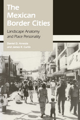
The Mexican Border Cities draws on extensive field research to examine eighteen settlements along the 2,000-mile border, ranging from towns of less than 10,000 people to dynamic metropolises of nearly a million. The authors chronicle the cities' growth and compare their urban structure, analyzing them in terms of tourist districts, commercial landscapes, residential areas, and industrial and transportation quarters.
Arreola and Curtis contend that, despite their proximity to the United States, the border cities are fundamentally Mexican places, as distinguished by their cultural landscapes, including town plan, land-use pattern, and building fabric. Their study, richly illustrated with over 75 maps and photographs, offers a provocative and insightful interpretation of the geographic anatomy and personality of these fascinating—and rapidly changing—communities.
In The Middle East and the Making of the Modern World, Cyrus Schayegh takes up a fundamental problem historians face: how to make sense of the spatial layeredness of the past. He argues that the modern world’s ultimate socio-spatial feature was not the oft-studied processes of globalization or state formation or urbanization. Rather, it was fast-paced, mutually transformative intertwinements of cities, regions, states, and global circuits, a bundle of processes he calls transpatialization.
To make this case, Schayegh’s study pivots around Greater Syria (Bilad al-Sham in Arabic), which is roughly coextensive with present-day Syria, Jordan, Lebanon, and Israel/Palestine. From this region, Schayegh looks beyond, to imperial and global connections, diaspora communities, and neighboring Egypt, Iraq, and Turkey. And he peers deeply into Bilad al-Sham: at cities and their ties, and at global economic forces, the Ottoman and European empire-states, and the post-Ottoman nation-states at work within the region. He shows how diverse socio-spatial intertwinements unfolded in tandem during a transformative stretch of time, the mid-nineteenth to mid-twentieth centuries, and concludes with a postscript covering the 1940s to 2010s.
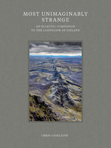
Described by William Morris as “most unimaginably strange,” the landscape of Iceland has fascinated and inspired travelers, scientists, artists, and writers throughout history. This book provides a contemporary understanding of the landscape as a whole, not only its iconic glaciers and volcanoes, but also its deserts, canyons, plants, and animals. The book examines historic and modern scientific studies of the landscape and animals, as well as accounts of early visitors to the land. These were captivating people, some eccentric but most drawn to Iceland by an enthrallment with all things northern, a desire to experience the land of the sagas, or plain scientific and touristic curiosity. Featuring many spectacular illustrations, this is a fine exploration of a most singular landscape.
READERS
Browse our collection.
PUBLISHERS
See BiblioVault's publisher services.
STUDENT SERVICES
Files for college accessibility offices.
RECENTLY PUBLISHED


")


UChicago Accessibility Resources
home | accessibility | search | about | contact us
BiblioVault ® 2001 - 2024
The University of Chicago Press